city History
Greenville, South Carolina is a midsized American city that provides a window into urban history and theory. It reveals the ideas of major movements in urban planning such as the City Beautiful, Urban Renewal modernism, and the post-modern recovery of pre-modernist urbanism. As a result of suburbanization and adapting the city to the automobile, in Greenville’s history we can see the death and life of the city and its downtown as a place for living.
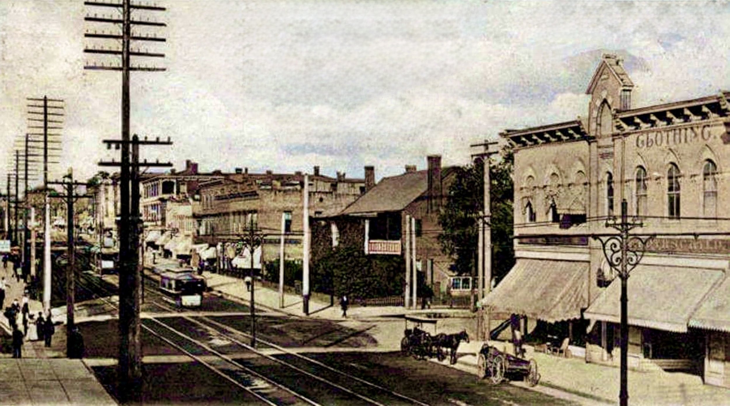
Main Street before the car.
Greenville’s Main Street around 1902, looking north. A streetcar passes the 1820 home of Sarah Cleveland at the corner of McBee Avenue. Around this time the city’s population was over 13,000 and there were only four automobiles registered in Greenville County. Streetcar tracks connected downtown, residential neighborhoods, and textile mills.
Postcard, public domain, colorized.
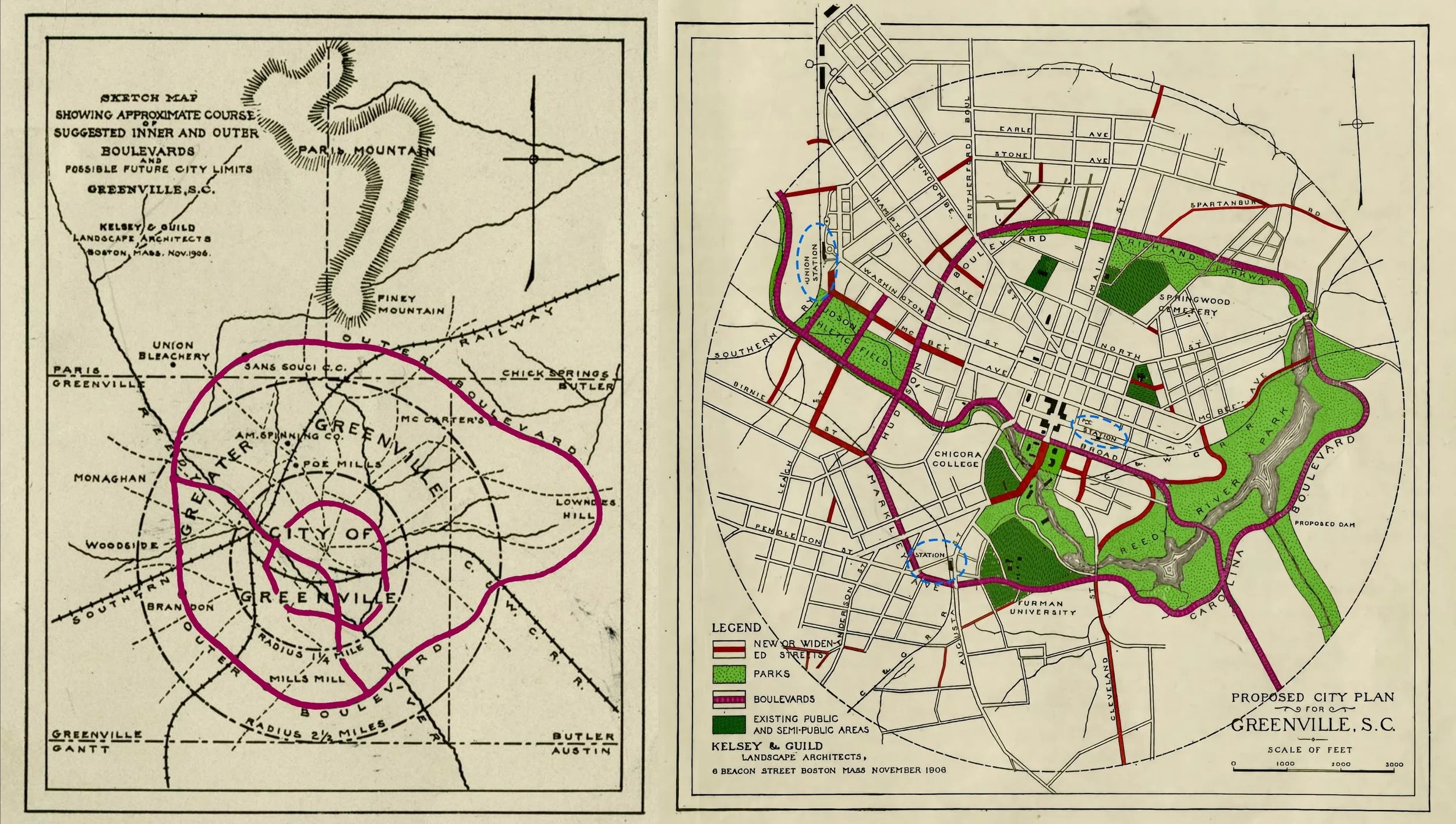
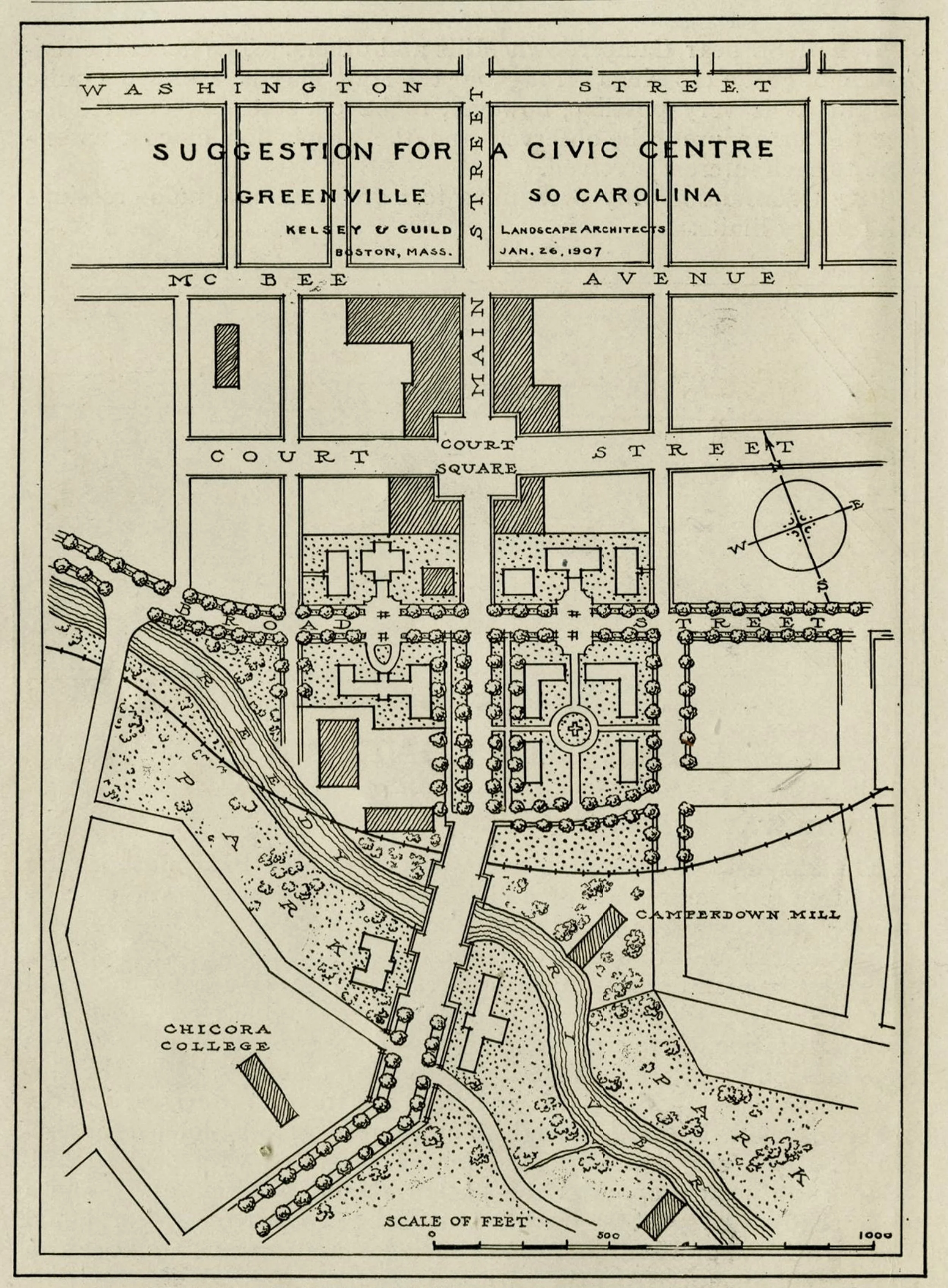
Greenville city beautiful.
In 1907, Kelsey & Guild Landscape Architects of Boston shared a plan for the improvement of Greenville that included architectural, urban design, transportation, and public health improvements, although it also promoted racial segregation. Some of the physical improvements were later adopted, such as development of Reedy River Park, the celebration of the river’s spectacular waterfalls, and the recent development of the Unity Park (on the Hudson Field site). The plan is notable for appearing just before the Age of the Automobile.
Beautifying and Improving Greenville, South Carolina: Report to the Greenville Municipal League, Boston, 1907. Colorized by the author. Greenville Public Library.
main street as highway.
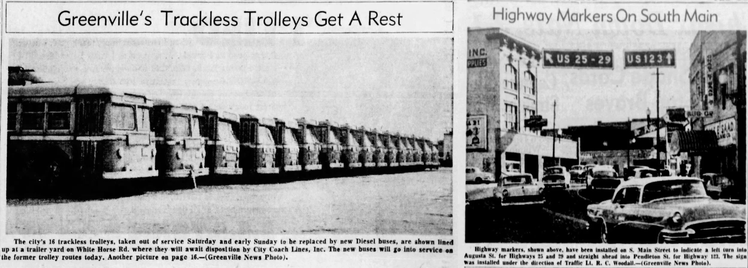
The first national program for building highways for automobiles was funded in 1916. In 1926 a new funding program created the US Numbered Highway System. This system created the 1,400-mile US Route 23, and later, US 123 which connects Greenville to US 23 in Georgia. When highways were first created, their general purpose was to connect towns and cities. It was therefore not uncommon for highways to run along main streets, as was the case in Greenville. In 1956, the city’s eighty-year-old trolley system was shut down when a new operator replaced the trackless trolleys with diesel buses. The public transit system would no longer have dedicated public space or a right of way along the city’s streets. When the electric trolley lines were removed, highway signs were installed in their place.
The Greenville News.
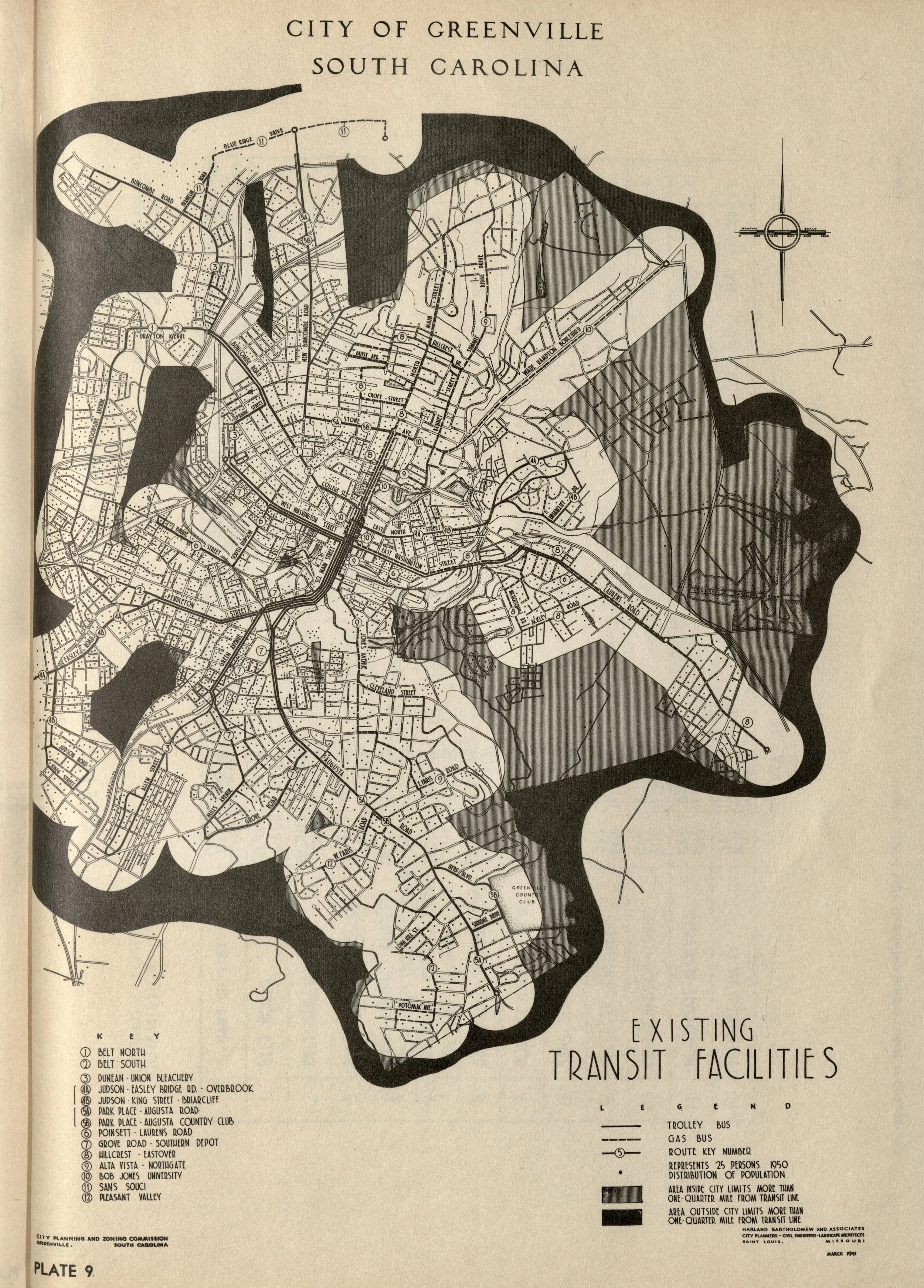
transit city.
This remarkable plan diagram from 1951 shows the relationship of Greenville’s neighborhoods and urban form in relationship to its public transit lines. At this time, 96% of the city’s population was within a quarter-mile of a trolley or bus line, as indicated by the white area. The less populated grey area was within city limits, while the black area was outside of city limits. Although car ownership was significant, and soon to eclipse public transportation completely, at the time it was understood that what was later termed “transit oriented development” was important to prevent sprawl.
Harland Bartholomew and Associates City Planners, Comprehensive City Planning, Greenville, South Carolina (St. Louis, 1950). Greenville Public Library.
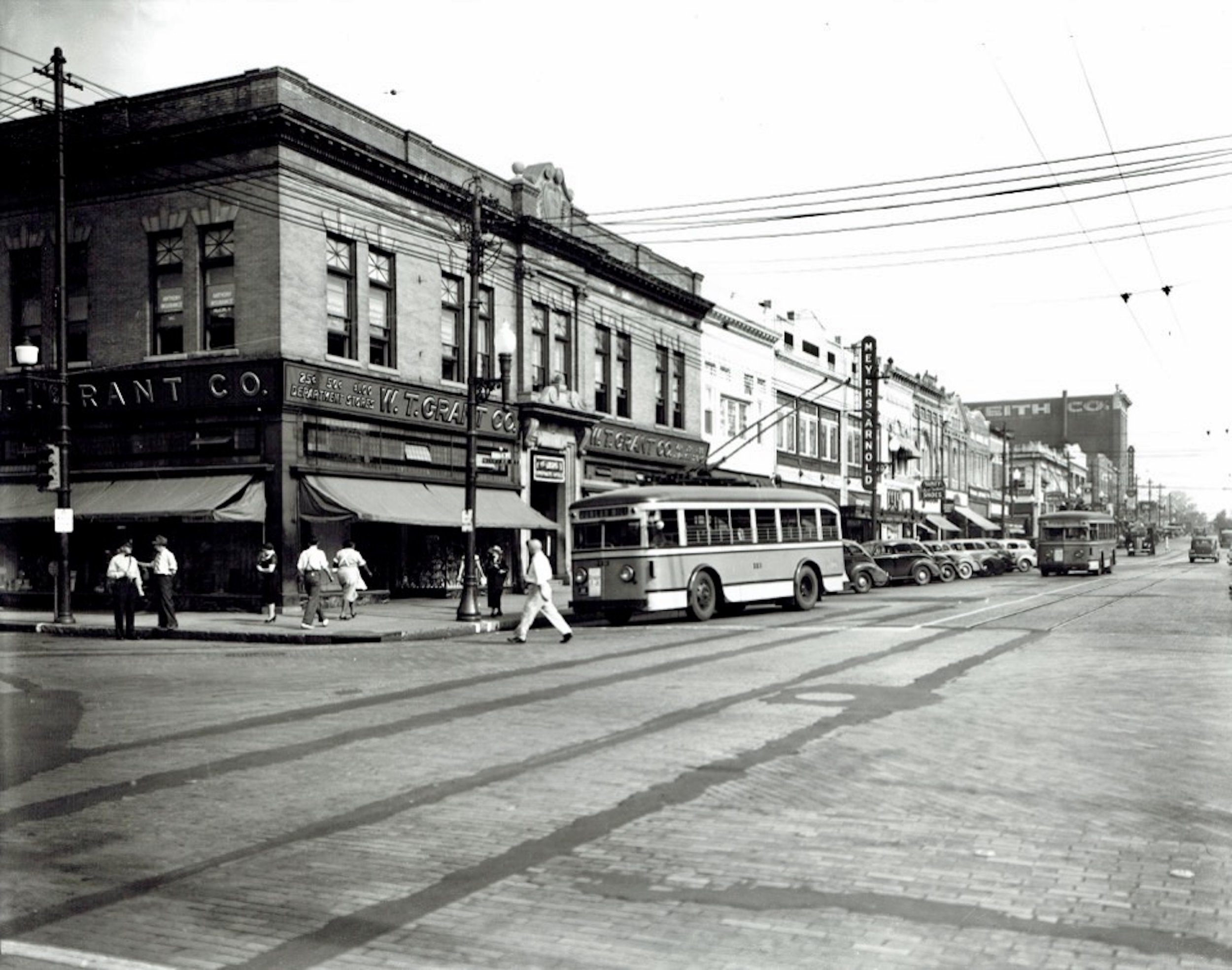
from streetcars to trolleys.
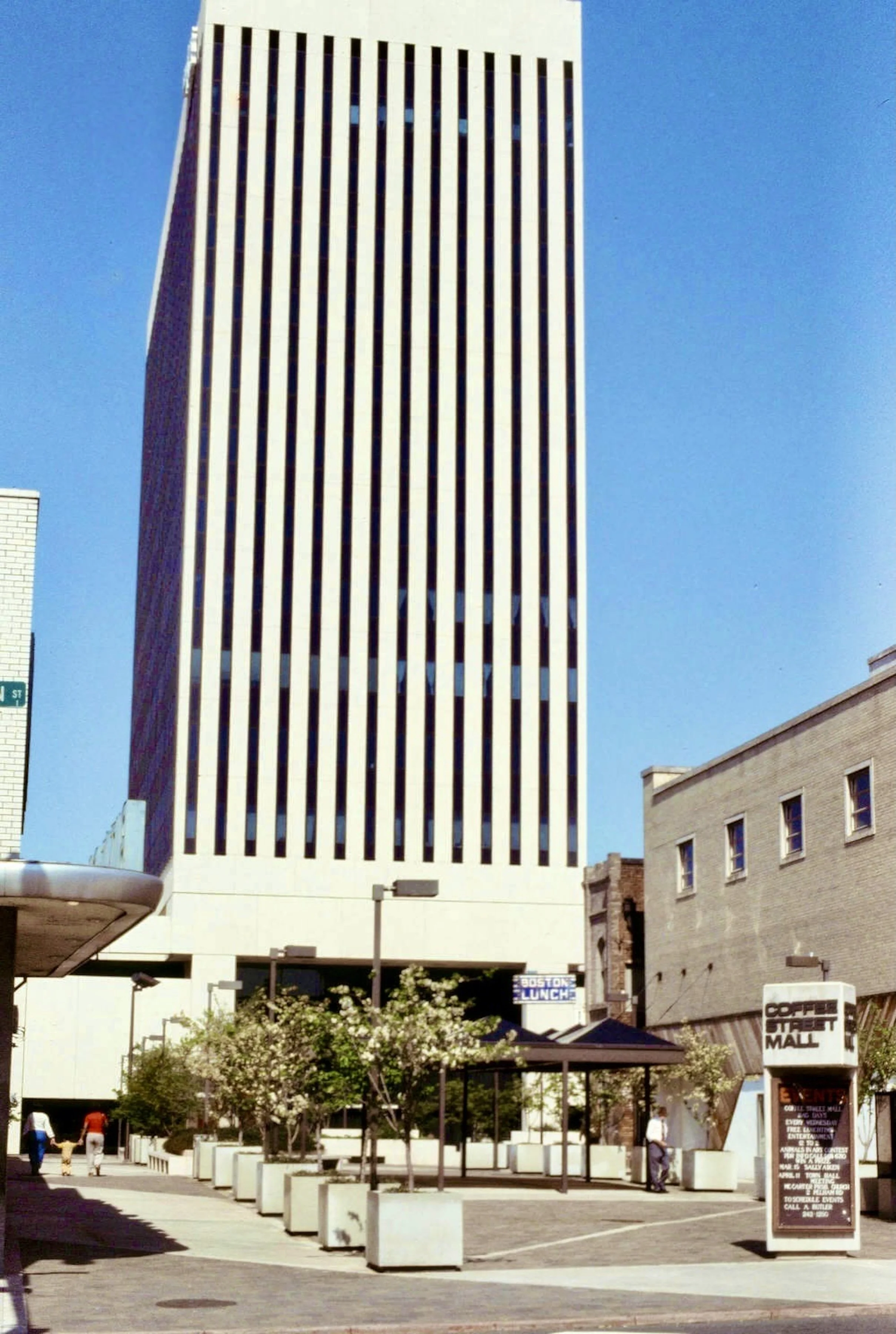
The first rails for streetcars were installed on Greenville’s Main Street in the 1870s. These were pulled by horses and mules before the cars were electrified in 1901. As seen in this photo, by the mid 1930s, the rails were being removed (the street patched with asphalt) and the streetcars were being replaced by electric trolleybuses. Some twenty years later the electric trolleybuses, aka trackless trolleys, would be replaced by diesel motor buses. In the photo, the intersection on the left is West Coffee Street, which became the Coffee Street Mall in 1974, and later Piazza Bergamo and then Greenville One Plaza.
Courtesy Greenville Historical Society.
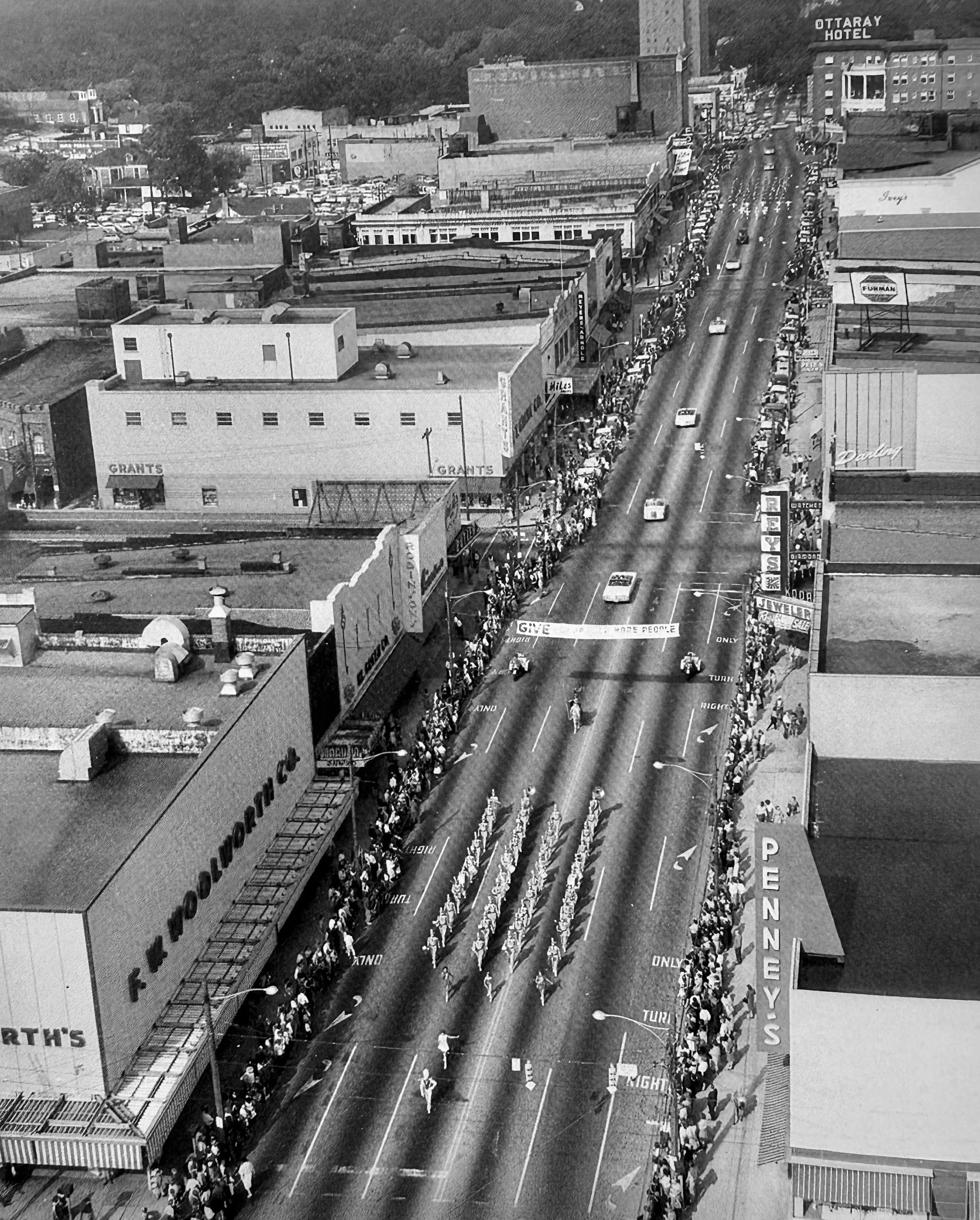
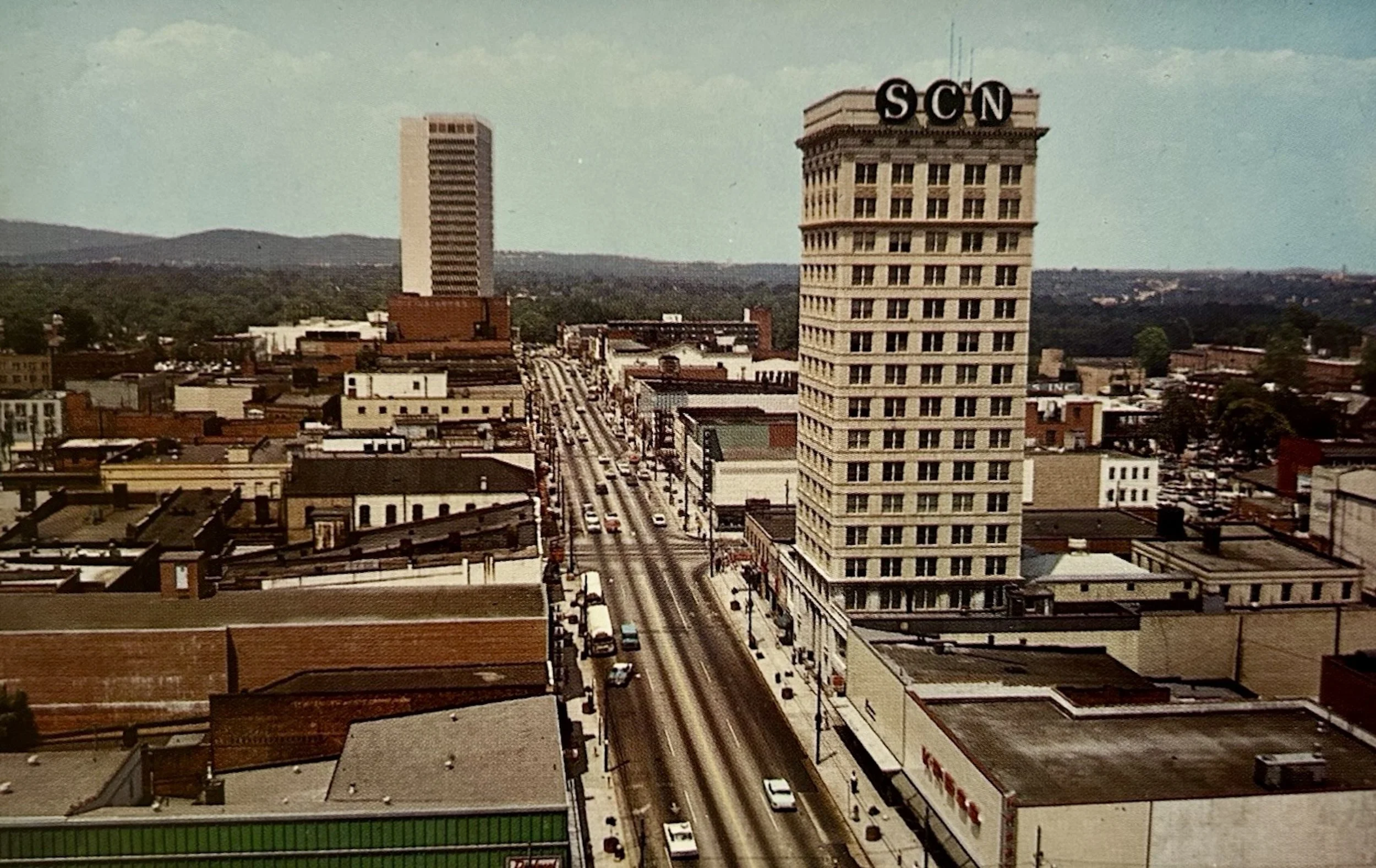
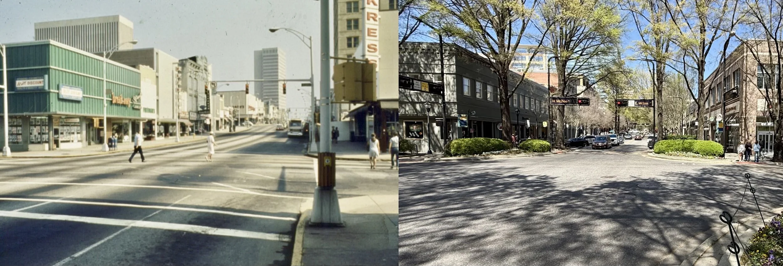
main street a six-lane highway.
These photos show that as US 123, Greenville’s Main Street was once a six-lane highway, at least in the stretch north of McBee Avenue. For much of the early 20th century, Main Street was a four-lane road with diagonal parking. By 1960, due to traffic congestion and the desire of merchants to make downtown access easier for drivers, the on-street parking was eliminated. By this time there were also ideas for making Main Street more like a suburban shopping center with parking garages behind the Main Street buildings.
Left image, Main Street during a Christmas Parade prior to 1960, when the Ottaray Hotel was demolished. Between Rey’s and Grant’s is Coffee Street prior to the closure of West Coffee Street for the construction of the Peoples National Bank urban-renewal project with its tower, parking garage, and small pedestrian mall. Image courtesy Furman University Special Collections. Right image, a postcard, c.1966. The Daniel (Landmark) Building was completed in 1966. The Woodside (SCN) Building was later demolished in 1974 for another urban renewal project with a new bank building.
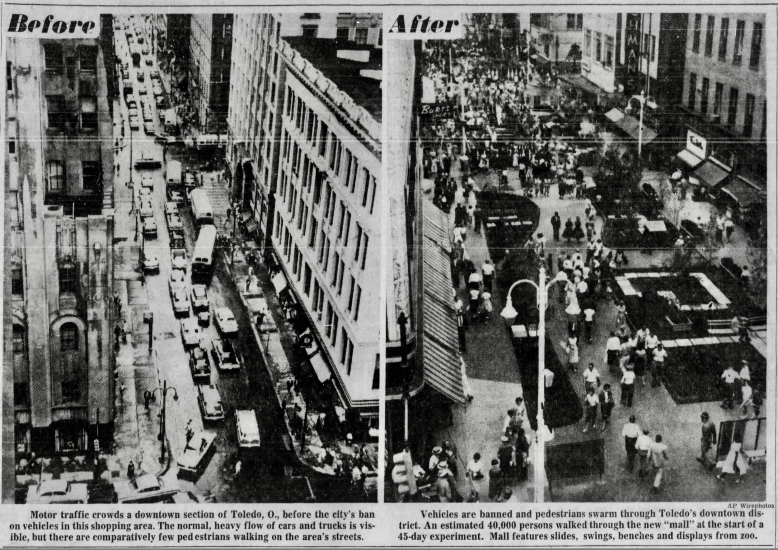
the pedestrian mall movement.
With increasing car-ownership came suburban development, and by the 1950s, downtowns were re-conceived primarily as business districts. Although traffic congestion and lack of parking in cities that were originally designed to be walkable could perhaps be fixed by widening roads and building parking garages, the problem of downtown’s historic role as shopping districts was more difficult to solve. In the 1950s and into the 60s, downtown merchants were losing business to new car-oriented suburban shopping centers and strips. The Pedestrian Mall movement of the 1950s to 1970s was a response to this geographic shift and an attempt to make downtowns more mall-like. As seen above, in Toledo, Ohio, a few city blocks were temporarily converted into a pedestrian mall in 1959. In the same year, the first permanent street-to-pedestrian-mall conversion was built in Kalamazoo. Both malls received extensive press in newspapers across the United States, inspiring other cities to consider and experiment with temporary and permanent mall designs.
The Philadelphia Inquirer.
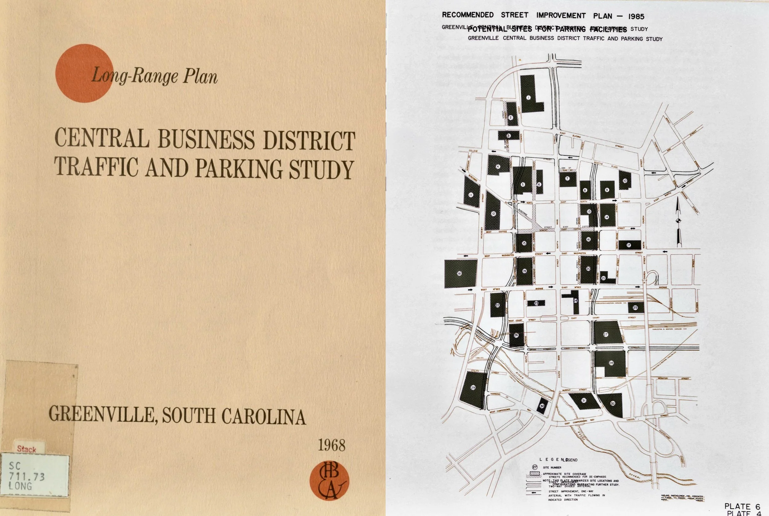
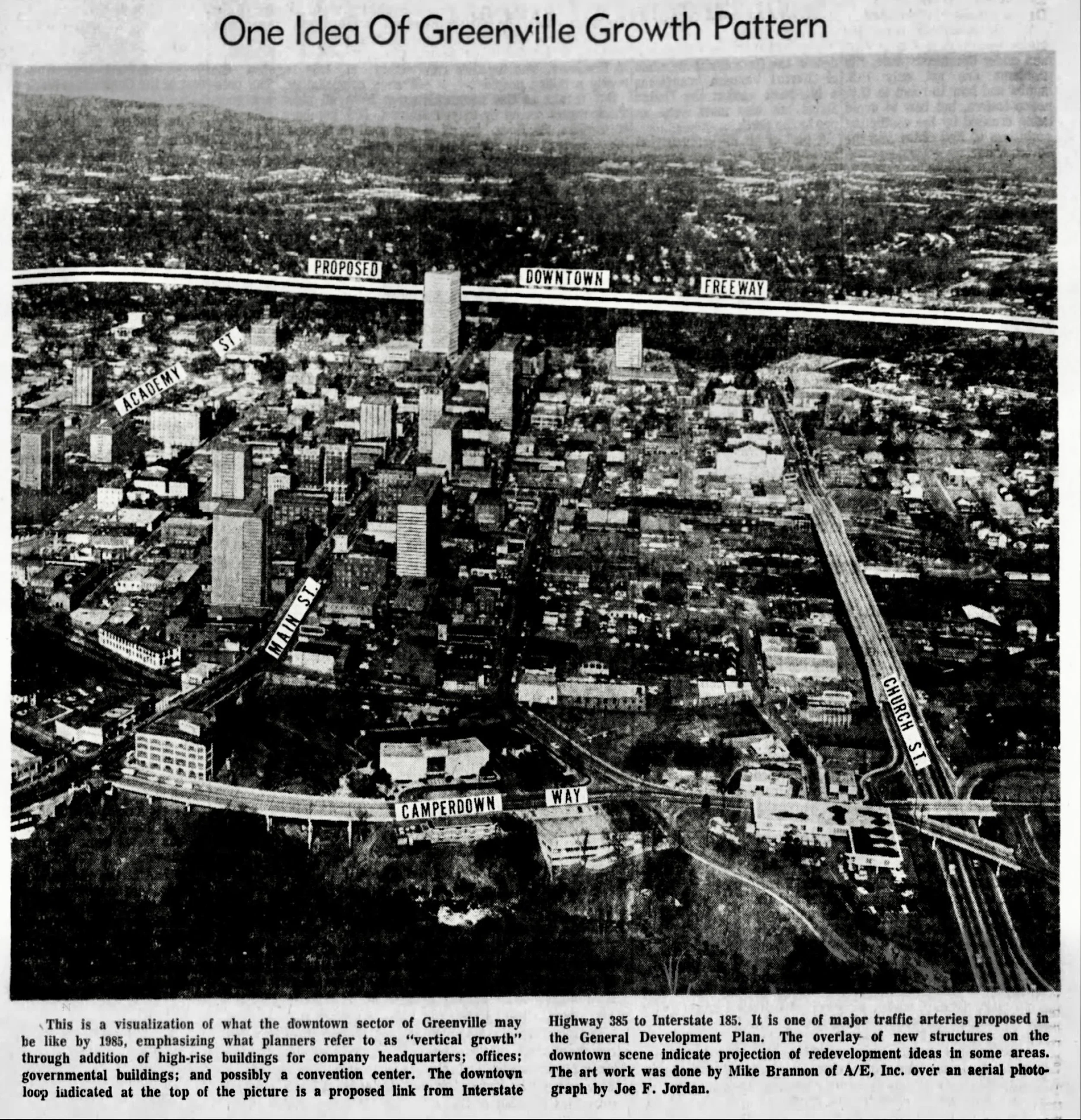
the highway building /urban renewal era.
As early as 1946 a series of expressways were proposed for serving Greenville’s downtown or central business district (CBD). The first built was the so-called “Church Street Expressway,” completed in 1960, which included the Camperdown Way bridge over the Reedy River falls. The next was the “Academy Street Expressway,” which was completed in 1968. (Later called simply Church and Academy streets, people became used to their width.) Also widened along its length, US Highway 123 was then moved from Main Street to Academy, creating an expressway “loop” around downtown. The image on the left from 1967 imagines what Greenville might look by 1985, with new highways and office towers. Around this time, four more expressways were proposed, which would have created a “Downtown Loop.” These included the “Downtown Freeway” shown in the image above and also a southern “Reedy River Freeway,” which would have run through or alongside the existing park. Around the same time, the 1968 Central Business District Traffic and Parking Study proposed turning as much as half of the land in Greenville’s downtown into parking (shown in black). By this time, however, these were desperate measures— people no longer lived or shopped downtown in numbers necessary for its success.
The Greenville News. Harlan Bartholomew and Associates, Long-Range Central Business District Traffic and Parking Study, Greenville, South Carolina, 1968. Greenville Public Library. Composite image by the author.
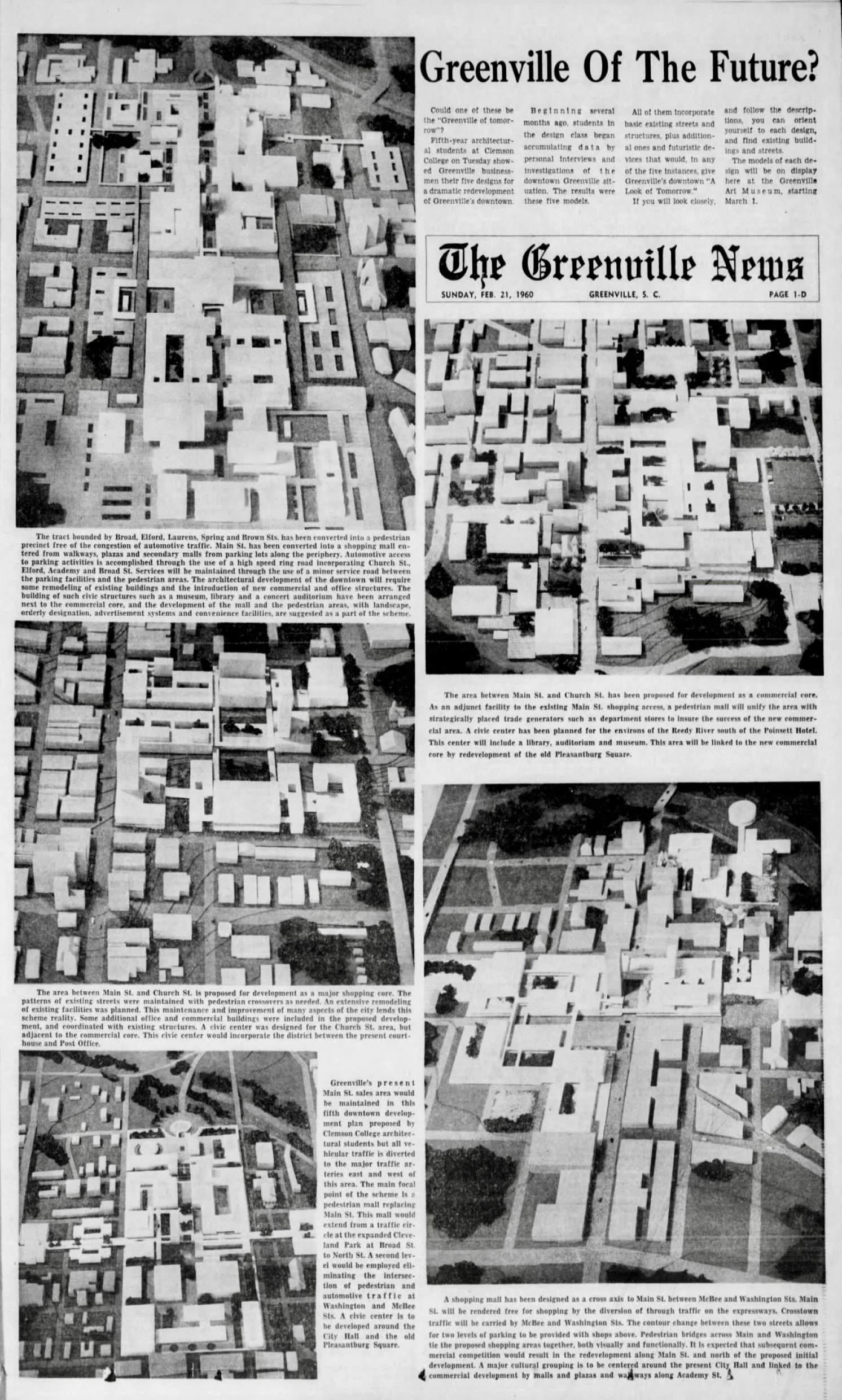
visions of transformation in 1960.
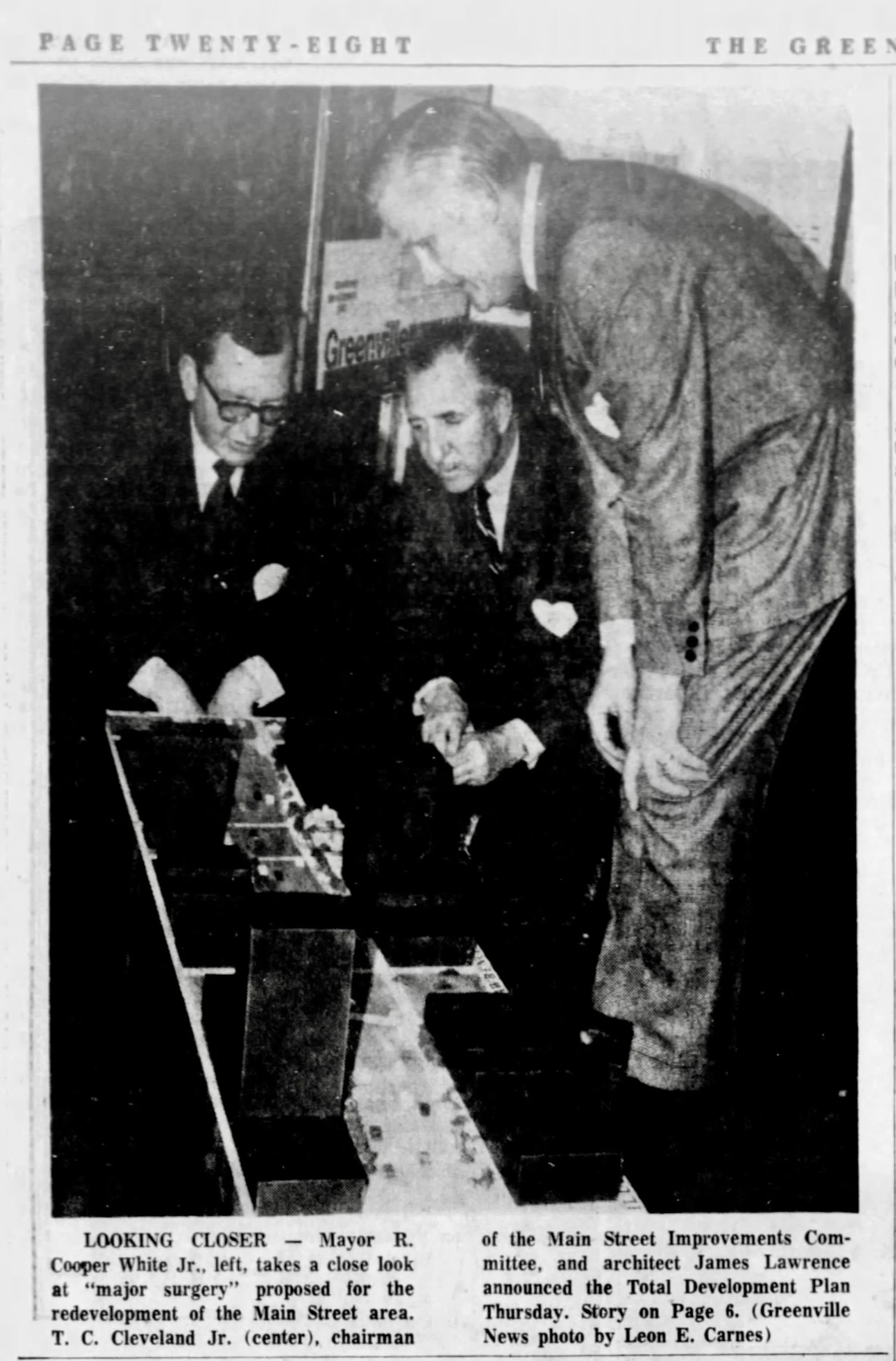
In 1960, The Greenville News published projects by five student teams from Clemson College of Architecture. These projects were presented to several civic organizations and displayed in the Greenville Art Museum. The projects generally centered around Main Street and the “mall” concept. For example, one was described as follows: “Main Street has been converted into a shopping mall entered from walkways, plazas and secondary malls from parking lots along the periphery.” All schemes included pedestrian bridges, even across some narrow streets, to further separate drivers and pedestrians. They also included such civic programs as a library, museum, and an auditorium. The ideas about transforming Main Street around this time were materialized to some extent in later urban renewal projects, such as the Coffee Street Mall, and eventually in the iconic redesign of the street by Lawrence Halprin and Associates.
The Greenville News. Right, the Coffee Street Mall was part of a larger 1972 urban renewal project that included the bank tower, a parking garage, and the widening of Richardson Street; it was Greenville’s first pedestrian mall. Image courtesy South Carolina Room Archives, Greenville Public Library.
towards a new main Street.
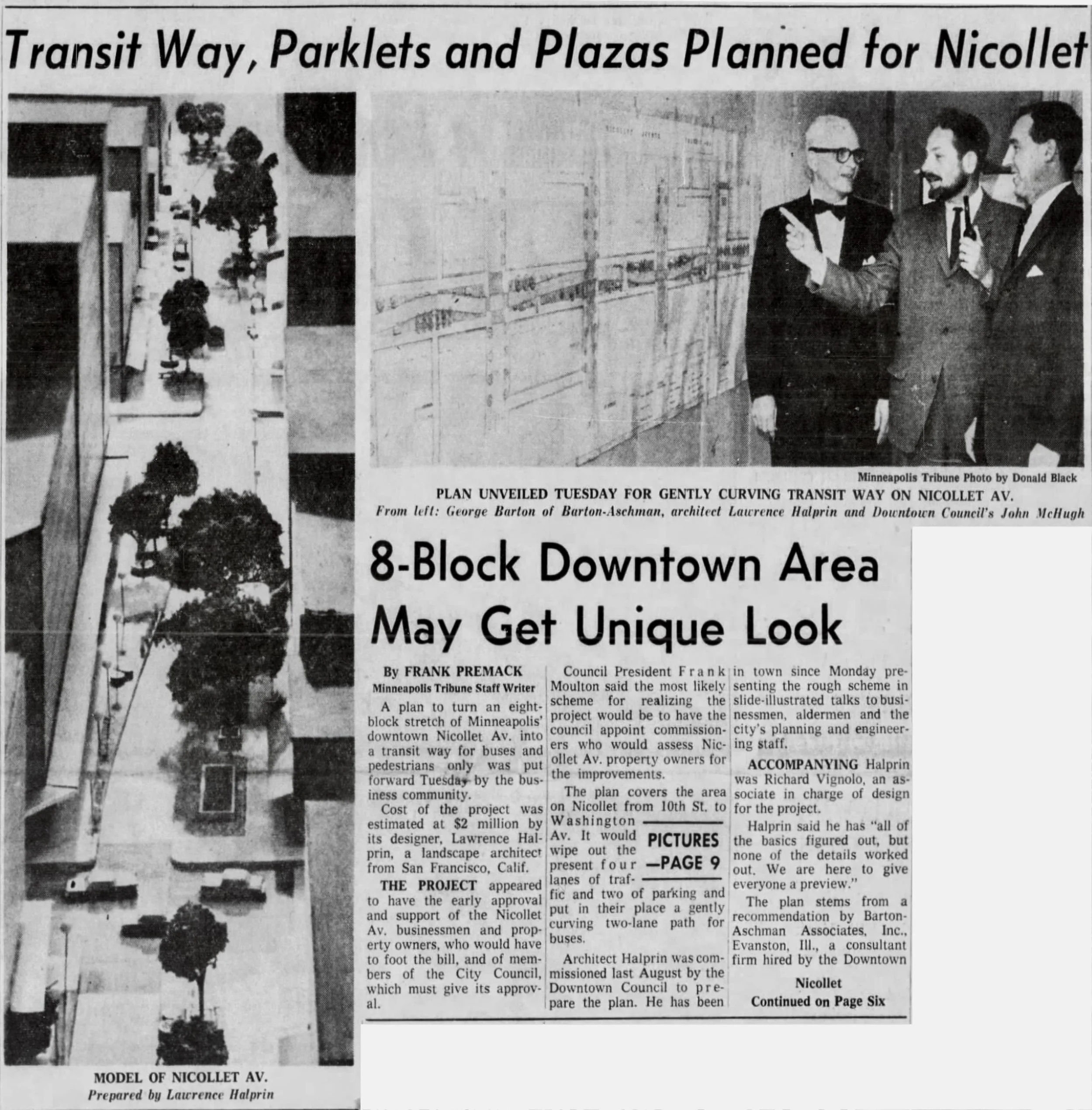
By 1970, downtown Greenville had a loop of highways and had lately embraced urban renewal. Influenced by the nationwide Pedestrian Mall movement, the city was now ready to redesign Main Street. In 1970, local architect James Lawrence, right, presented his idea of transforming Main Street into a “strollway.” The design would “eliminate sidewalks as we know them,” replacing them with a curving, serpentine path of paving from Broad to College Street. The curving pathway would reduce traffic flow and the varying width would allow wider portions to be landscaped with trees, shrubbery, and blooming plants “to eliminate the daily confrontation of cars and people.” The design was an early proposal for a “road diet,” in which lanes and public space given over to cars would be reclaimed for walking and other uses. James Lawrence’s design was also likely influenced by the Nicollet Avenue “transit way” designed by landscape architect Lawrence Halprin. The Nicollet Mall received a great deal of publicity and may have influenced the decision to hire Halprin and Associates to redesign Greenville’s Main Street.
The Greenville News.
greenville’s model main street.
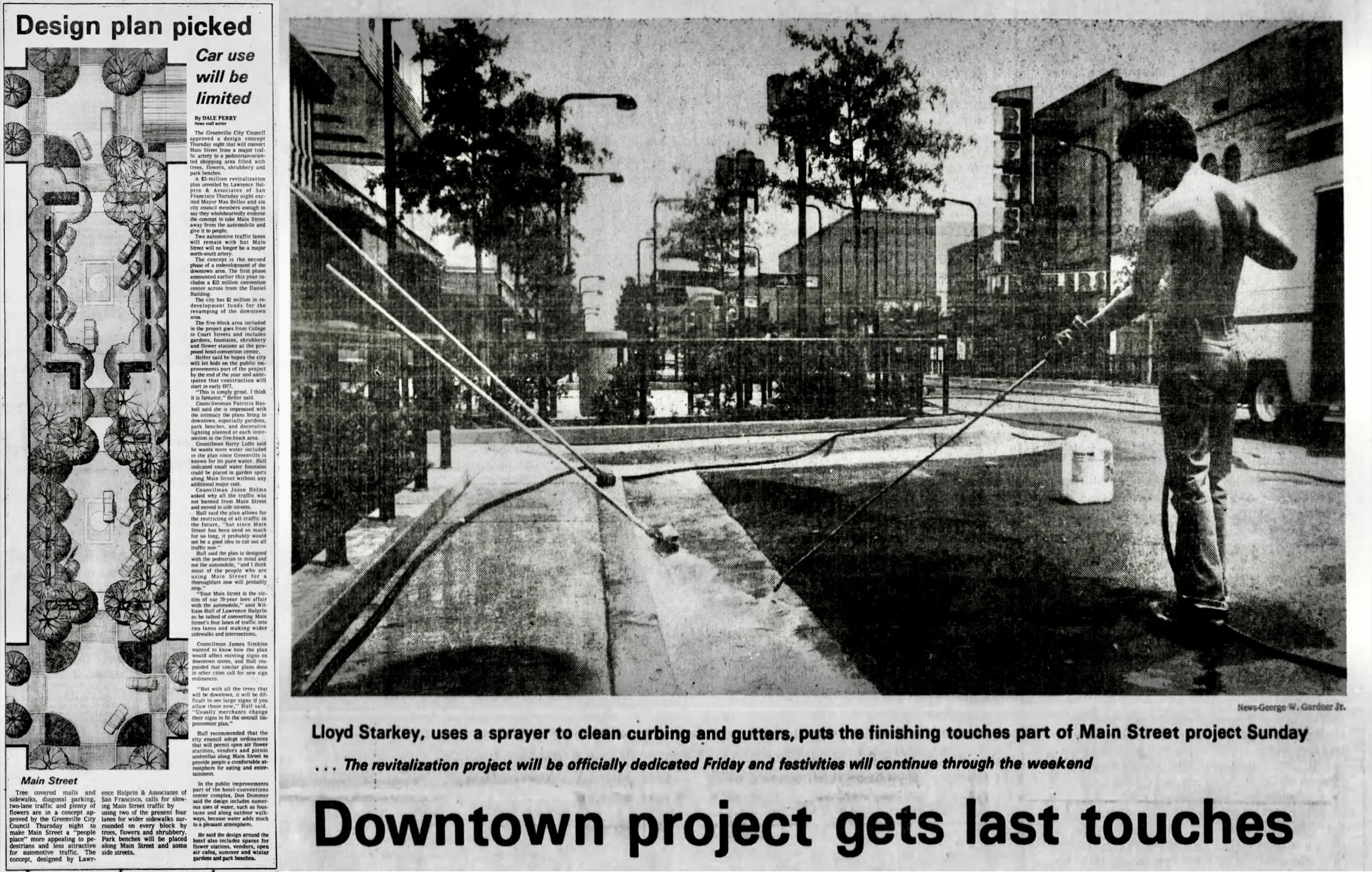
Halprin and Associates’ presented a drawing for the redesign of Greenville’s Main Street in 1977. In March 1977, a Halprin associate presented four options for redesigning five blocks of Main Street to the City Council. Option 1 would keep four lanes of traffic and add extended sidewalks at intersections. Option 2 would narrow Main Street to two lanes with a center tree-lined median. Options 3 and 4 would narrow the blocks to two lanes but one with parallel and the other with diagonal parking. There was also discussion about turning the street into a pedestrian mall, closed to traffic. Ultimately, the option of two lanes with diagonal parking became the basis for the current street. Main Street, The Greenville News reported, would no longer be “a major north-south artery.” The redesign would “take Main Street away from the automobile and give it to people.” Time and history have shown that the selected “road diet” design was probably the best. With a mix of uses, it is expandable and therefore more sustainable than a pedestrian mall.
The Greenville News.
from highway to great street.
The history of Greenville’s Main Street is local but also a much larger story of transportation, city planning, and livable cities. From a dirt road, a brick road with trolley lines, a six-lane asphalt highway, and now a beautifully landscaped two-lane street, the physical changes the street has seen represent changing ways, all of which we can learn from, of thinking about cities and their purpose.
Left, Main Street at McBee Avenue, circa 1978. Public domain. Right, photo by the author.